


Voting District 32, Roane County, West Virginia
About
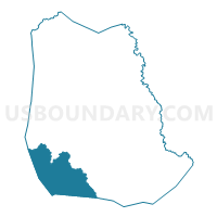
Outline

Summary
| Unique Area Identifier | 691887 |
| Name | Voting District 32 |
| County | Roane County |
| State | West Virginia |
| Area (square miles) | 41.08 |
| Land Area (square miles) | 41.08 |
| Water Area (square miles) | 0.00 |
| % of Land Area | 100.00 |
| % of Water Area | 0.00 |
| Latitude of the Internal Point | 38.59161850 |
| Longtitude of the Internal Point | -81.44974400 |
Maps


Graphs
Select a template below for downloading or customizing gragh for Voting District 32, Roane County, West Virginia


Neighbors
Neighoring Voting District (by Name) Neighboring Voting District on the Map
- Voting District 10, Roane County, WV
- Voting District 23, Jackson County, WV
- Voting District 29, Roane County, WV
- Voting District 30, Roane County, WV
- Voting District 419, Kanawha County, WV
- Voting District 423, Kanawha County, WV
- Voting District 434, Kanawha County, WV
- Voting District 7, Roane County, WV
Top 10 Neighboring County Subdivision (by Population) Neighboring County Subdivision on the Map
- District 4, Kanawha County, WV (47,899)
- Eastern district, Jackson County, WV (9,882)
- District III, Roane County, WV (5,018)
- District I, Roane County, WV (4,988)
Top 10 Neighboring Unified School District (by Population) Neighboring Unified School District on the Map
- Kanawha County School District, WV (193,063)
- Jackson County School District, WV (29,211)
- Roane County School District, WV (14,926)
Top 10 Neighboring State Legislative District Lower Chamber (by Population) Neighboring State Legislative District Lower Chamber on the Map
- State House District 32, WV (51,970)
- State House District 12, WV (20,112)
- State House District 11, WV (17,258)
Top 10 Neighboring State Legislative District Upper Chamber (by Population) Neighboring State Legislative District Upper Chamber on the Map
- State Senate District 817, WV (193,063)
- State Senate District 4, WV (117,998)
- State Senate District 3, WV (109,227)
Top 10 Neighboring 111th Congressional District (by Population) Neighboring 111th Congressional District on the Map
Top 10 Neighboring Census Tract (by Population) Neighboring Census Tract on the Map
- Census Tract 9637, Jackson County, WV (8,193)
- Census Tract 111, Kanawha County, WV (4,744)
- Census Tract 112, Kanawha County, WV (4,619)
- Census Tract 9629, Roane County, WV (4,462)
- Census Tract 9631, Roane County, WV (4,041)
- Census Tract 108.02, Kanawha County, WV (3,249)
Top 10 Neighboring 5-Digit ZIP Code Tabulation Area (by Population) Neighboring 5-Digit ZIP Code Tabulation Area on the Map
- 25071, WV (11,697)
- 25320, WV (6,084)
- 25045, WV (5,801)
- 25248, WV (3,090)
- 25286, WV (1,692)
- 25243, WV (899)